使用期限租赁和永久
许可形式单机和网络版
原产地美国
介质下载
适用平台windows
北京天演融智软件有限公司(科学软件网)前身是北京世纪天演科技有限公司,成立于2001年,专注为国内高校、科研院所和以研发为主的企事业单位提供科研软件和服务的国家。
We know that fewer than 5% of our customers have ever created full-color 3D printed models of their EVS modeling projects. We appreciate that all projects have tight cost constraints, but we also know that few Program Managers have ever had the opportunity to hold a 3D printed model in their hands, let alone

Image Files (all formats) to Use as Texture Maps (overlays)
ArcGIS
U*** SDTS and DEMs
ArcGIS
ESRI Shapefiles (ARC/INFO®, ArcGIS®, and ArcView®)
ArcGIS
C Tech 4D Interactive Models (4DIM) Playback

Mining Visualization System (MVS)是C Tech的分析和可视化的旗舰产品。MVS是从地面向地下和地表开采满足分析要求而设计的。然而,它所使用的工具也是土木和的环境建模。MVS EVS-PRO构建所有的功能,并增加了强大的新功能针对矿业的需求,满足规划师、土木、地质学家和环境苛刻的要求。
MVS的一些特的特性包括:3D断块代;矿体和羽流表土建模;隧道切割;矿井建模;许多额外的特性。
地质统计学功能
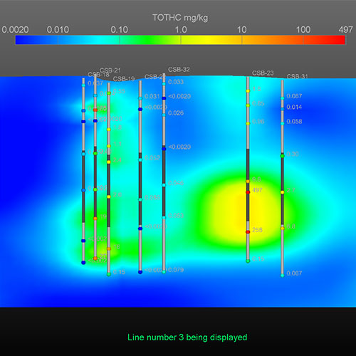
MVS地质统计学模块被用来估计黄金浓度使用所有可用的分析数据。所有地区的非盟级以上30磅的显示,根据地层学与矿色。
系统要求
操作系统:Microsoft® Windows® 7, 8 或10 64 bit。我们推荐Windows 8.1或10,64 bit,并且是OS系统。
RAM:足够的内存很大程度上取决于应用程序和数据。我们推荐小4GB,强烈推荐8-32GB。
科学软件网是一个以引进国外科研软件,提供软件服务的营业,由天演融智软件有限公司创办,旨在为国内高校、科研院所和以研发为主的企业事业单位提供的科研软件及相关软件服务。截止目前,科学软件网已获得数百家国际软件公司正式授权,代理销售科研软件达一千余种,软件涵盖领域包括经管,仿真,地球地理,生物化学,工程科学,排版及网络管理等。同时,还提供培训、视频课程(包含34款软件,64门课程)、实验室解决方案和项目咨询等服务。
不管您是需要购买单款软件,还是制定整个实验室的购买方案,都可以提供。

Compute Isolines displayed on the surface of a model which accurately follow the data at a sub-feature level.
3D Volumetric Plumes representing a 3D subset of your model based on any attribute. All data within the volumetric model will be retained in the volumetric subset.
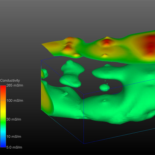
Isosurfaces are 3D surfaces that represent a constant value within a 3D volume. These surfaces can represent a depth below ground surface, a constant concentration within a volume or any other 2D subset of the volume. All data within the volumetric model will be mapped to the surface.
科学软件网专注提供正版软件,跟上百家软件开发商有紧密合作,价格优惠,的和培训服务。
http://www.kxrjsoft.com.cn


