使用期限租赁和永久
许可形式单机和网络版
原产地美国
介质下载
适用平台windows
科学软件网销售EVS(Earth Volumetric Studio)地质建模软件达19年,拥有丰富的销售和技术服务经验。
Earth Volumetric Studio环境可视化和挖掘可视化系统
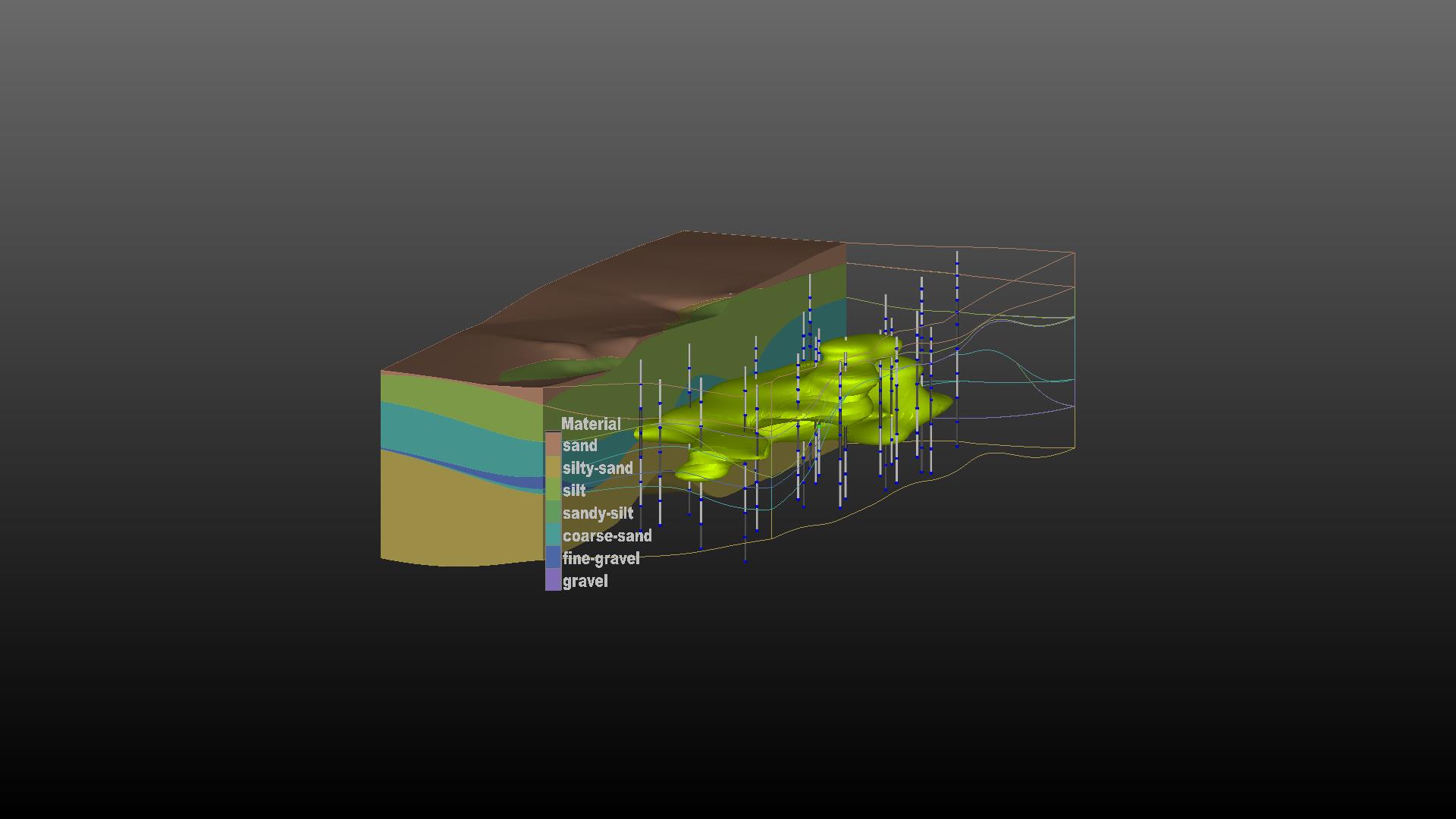
Earth Volumetric Studio是Environmental Visualization System和Mining Visualization System,结合多年EnterVol开发的一个革命性的集成软件。Earth Volumetric Studio在更新的,友好的用户环境中保留了之前版本的模块化工具包范例。Earth Volumetric Studio是一个立的Windows程序,它可以提供的运行速度、功能和灵活性。Studio了的体积网格,地球统计分析和4D可视化工具,应用于所有地球科学学科。图形用户界面集成了模块化分析和图形例程,可以定制和组合,以满足任何应用程序的分析和可视化需求。Studio可以用来分析任何环境中所有类型的分析和地球物理数据。(如土壤、地下水、地表水、空气、噪音、电阻率等)。Earth Volumetric Studio的综合地质统计学提供了对数据和站点模型质量的定量评估,并确定需要额外数据收集的位置。
C Tech’s software is used by government agencies, universities and companies around the world. Our customers include the United Nations, U.S. Environmental Protection Agency, Environment Canada, U.S. Geological Survey, British Geological Survey, U.S. Army Corps of Engineers, U.S. Department of Energy Laboratories, U.S. Nuclear Regulatory Commission, U.S. Department of Transportation, and the majority of the world’s largest engineering and environmental consulting firms.
Environmental database and data management software products such as Microsoft Excel & Access, ESRI’s ArcView, ArcINFO and ArcGIS, gINT Professional and EarthSoft’s EQuIS, & EScIS’ ESdat are also supported.

Rendered Output Formats
OpenGL Rendered Bitmpas at Screen Resolutions
ArcGIS
High Resolution Rendered Bitmap Images (all formats)
ArcGIS
High Resolution Georeferenced BMP and World Files
ArcGIS
Animation Output as AVI, MPEG, and HAV (lossless)

Earth Volumetric Studio环境可视化和挖掘可视化系统
Earth Volumetric Studio是Environmental Visualization System和Mining Visualization System,结合多年EnterVol开发的一个革命性的集成软件。Earth Volumetric Studio在更新的,友好的用户环境中保留了之前版本的模块化工具包范例。Earth Volumetric Studio是一个立的Windows程序,它可以提供的运行速度、功能和灵活性。Studio了的体积网格,地球统计分析和4D可视化工具,应用于所有地球科学学科。图形用户界面集成了模块化分析和图形例程,可以定制和组合,以满足任何应用程序的分析和可视化需求。Studio可以用来分析任何环境中所有类型的分析和地球物理数据。(如土壤、地下水、地表水、空气、噪音、电阻率等)。Earth Volumetric Studio的综合地质统计学提供了对数据和站点模型质量的定量评估,并确定需要额外数据收集的位置。
Earth Volumetric Studio将以前开发的Environmental Visualization System Pro和MVS (Mining Visualization System)的功能都囊括在了一个功能更强大操作更简单的环境之中。功能包括:钻孔和样本发布;参数估计使用拟合函数的系统驱动的2D和3D Kriging算法;爆裂地质层;有限差分网格生成的有限元建模;网格;拥有几乎所有功能的Python脚本;高水平动画支持;交互式3D栅栏图;多分析物的数据分析和综合容积和质量计算土壤及地下水污染和矿体。还有一些以前我们从MVS软件中了解到的,满足矿业、规划师,或地质学家和环境们苛刻的要求。这些功能包括:3D断块迭代;隧道挖掘;纹理映射;矿井建模;矿体覆盖的可视化与建模以及其他附加的功能。
The video includes still images from every application in each project, as well as a few short teaser animations. The Project Folders were:
Anisotropic Variography Study
Ashtabula Uranium Processing Plant
Camp Pendleton Marine Base
Coastal Facility with TOTHC Contamination
Dense and Oversampled Data
DrillGuide(TM) and 2D Kriging
Excavation and Tunnelling
Exporting Data to C Tech File Formats
Fault Modeling
Geophysics and Mining
Head Data and Seepage Velocity
Lake and Ocean Sciences
Lithologic Geologic Modeling
Modeling LNAPL as a Stratrigraphic Layer
MODFLOW and MT3D Visualization
Railyard Facility Complex Python Scripting
Reference
Salt Caverns for Oil and Gas Storage
Stratigraphic Geologic Modeling
TCE Time Domain Kriging
Time Varying Water Table Animation
Total HC at a Painting Facility
Unions-Intersections and Multiple Analytes
Xylene in Non-Vertical Borings

C Tech offers 3D model printing as a service to our clients. We assist with modification of the models to ensure the models print correctly the first time and perform the actual printing.
科学软件网专注提供正版软件,跟上百家软件开发商有紧密合作,价格优惠,的和培训服务。
http://www.kxrjsoft.com.cn


